Intelligent Patrol and Inspection System Using UAV
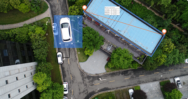
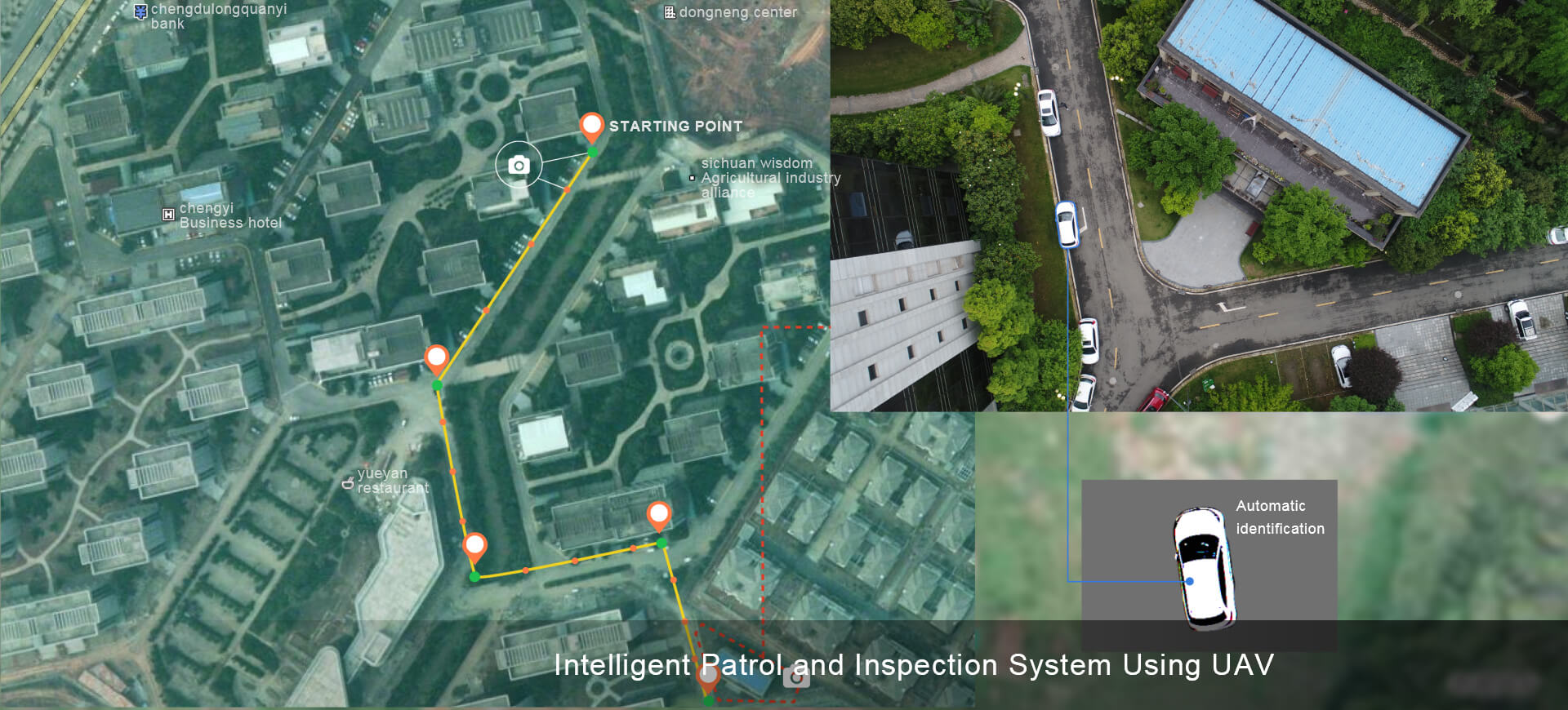
Intelligent Patrol and Inspection System Using UAV uses multiple UAV platforms such as composite wing and multi-rotor wing, carries high-definition visible light camera, infrared camera and other mission loads to carry out deep integrated development. The system has the functions of high-precision positioning, path autonomous planning, full-automatic flight, abnormal automatic analysis, database management and so on. It can inspect the roads, bridges, municipal facilities, power plants and other infrastructure, providing customized system solutions for industry users.
Intelligent Patrol and Inspection System Using UAV consists of a UAV system and an inspection information management system. The UAV system is a front-end data acquisition tool. According to the specific application requirements, it can select the UAV carrier and the mission load module to establish an automatic take-off and landing, endurance and storage base station platform. The inspection information management system has task management, work monitoring, data management and analysis functions, and the task is fully automated through flight and data acquisition automatic control functions. The inspection process is intelligent, efficient, safe and the system is easy to use.


Task management
and data visualization system

Data acquisition system

Automatic data processing
System applications
Municipal facility inspection
Traffic road inspection
Upper bridge inspection
Environmental inspection
Safety inspection
Function parameter
UAV carrier: multi-rotor wing (fine detection) / fixed wing (large range inspection)
Working radius: 0-1km (multi-rotor wing) 40-200km (fixed wing)
Equipment carried: HD camera, video pod, laser radar, etc.
Task planning: automatic planning
Operation mode: vertical take-off and landing, autonomous flight
Positioning accuracy: 5cm
Data processing: automation analysis
Intelligent data acquisition
Fixed-wing and multi-rotor platforms complement each other to meet different inspection requirements
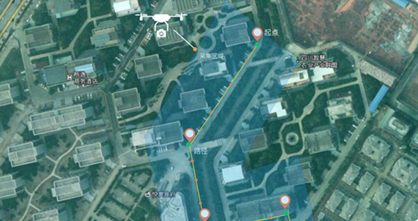
Multiple task planning methods, map selection, UAV dotting, mission planning
Fixed scene task repeated execution
One-click take-off and landing
Full automatic operation
One-click upload of data
Automatic data processing
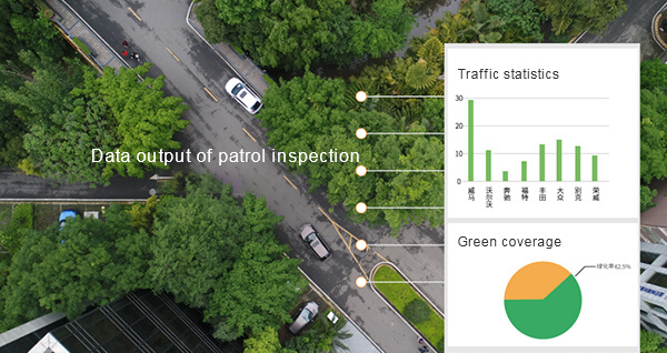
Good data consistency, accurate location label, facilitate follow-up automatic data processing
Multi-data source information fusion
Massive data automatic analysis
Historical data comparative analysis
Mass data visualization
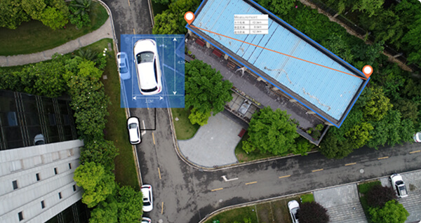
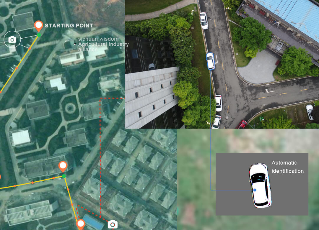
Intelligent Patrol and Inspection System Using UAV
Intelligent Patrol and Inspection System Using UAV
Intelligent Patrol and Inspection System Using UAV uses multiple UAV platforms such as composite wing and multi-rotor wing, carries high-definition visible light camera, infrared camera and other mission loads to carry out deep integrated development. The system has the functions of high-precision positioning, path autonomous planning, full-automatic flight, abnormal automatic analysis, database management and so on. It can inspect the roads, bridges, municipal facilities, power plants and other infrastructure, providing customized system solutions for industry users.
Intelligent Patrol and Inspection System Using UAV consists of a UAV system and an inspection information management system. The UAV system is a front-end data acquisition tool. According to the specific application requirements, it can select the UAV carrier and the mission load module to establish an automatic take-off and landing, endurance and storage base station platform. The inspection information management system has task management, work monitoring, data management and analysis functions, and the task is fully automated through flight and data acquisition automatic control functions. The inspection process is intelligent, efficient, safe and the system is easy to use.

Task management and data visualization system

Data acquisition system

Automatic data processing
System applications
Municipal facility inspection
Traffic road inspection
Upper bridge inspection
Environmental inspection
Safety inspection
Function parameter
UAV carrier: multi-rotor wing (fine detection) / fixed wing (large range inspection)
Working radius: 0-1km (multi-rotor wing) 40-200km (fixed wing)
Equipment carried: HD camera, video pod, laser radar, etc.
Task planning: automatic planning
Operation mode: vertical take-off and landing, autonomous flight
Positioning accuracy: 5cm
Data processing: automation analysis

Intelligent data acquisition
Fixed-wing and multi-rotor platforms complement each other to meet different inspection requirements
Multiple task planning methods, map selection, UAV dotting, mission planning
Fixed scene task repeated execution
One-click take-off and landing
Full automatic operation
One-click upload of data
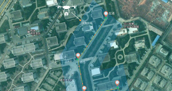
Automatic data processing
Good data consistency, accurate location label, facilitate follow-up automatic data processing
Multi-data source information fusion
Massive data automatic analysis
Historical data comparative analysis
Mass data visualization
