Robotic System for Road Disease Detection
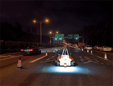
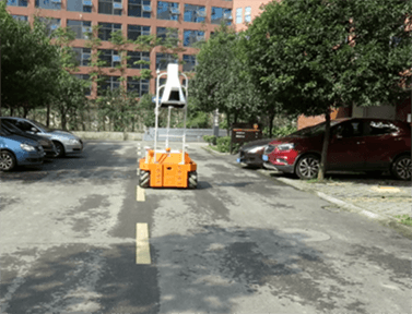
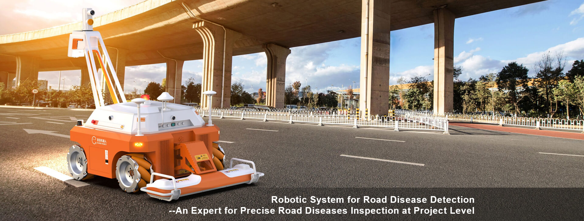
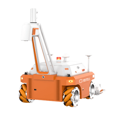
The road disease detection robot is a robot system specially used in project-level road disease investigation. It can accurately detect road surface and roadbed diseases in key areas according to the results of road network-level survey. The system is flexible in motion, and can complete turning and other actions in a single lane. Combined with high-precision positioning and navigation system, it can complete full automatic detection in the whole section. The system is equipped with two-dimensional and three-dimensional vision fusion system, as well as three-dimensional ground penetrating radar of different frequency bands. It collects road appearance and internal structure information synchronously. All kinds of data are accurately registered based on geographical position information. Combined with computer-aided analysis technology such as machine learning, the road appearance and internal information are fused on the same screen. The system can expand flatness, bearing capacity and other detection functions according to needs. The detection results can be customized to access the existing road information management system (road network information system), and combined with GIS and BIM models, the two-dimensional and three-dimensional visualized management can be performed on the disease.
System features
FUNCTIONAL FEATURES
Comprehensive
Full coverage of lane, road surface and roadbed structure disease
Accurate
centimeter-level positioning, high data density, good data quality consistency, high diagnostic accuracy for multi-type data fusion
Efficient
Data acquisition is automatic, data processing is intelligent
Safe
Intelligent obstacle avoidance, hard and soft dual emergency stop
Easy to use
Information fusion analysis of road and roadbed,visualized result output
Function parameter
Detection content:
Road disease: Cracks, pot hole, etc.
Type, position (accuracy 10cm), size (length error <5%, area error <10%)
Roadbed diseases: void, hollow, settlement, loose, watery.
Type, position (accuracy 5cm), depth, affected area, contour
Layer thickness: full coverage of the lane, accuracy 1cm
Concealed engineering: position and depth distribution of steel bars and dowel bars
Internal pipe network :(non) metal pipe and cable three-dimensional digital modeling
Single width: 0.9m-1.6m (customized)
Detection depth: 1m-3m (customized)
Operating speed: 0-10km/h
Positioning and navigation accuracy: 5cm
Endurance: 8h
System applications
Project acceptance:
Evaluation of layer thickness of road structure
Digital modeling of underground pipelines
Maintenance:
Fine survey of key road sections (based on road network census results)
Special investigation of maintenance
Preventive maintenance:
Preventive maintenance periodic monitoring
Road safety hazard investigation
Digital management of key road life cycle
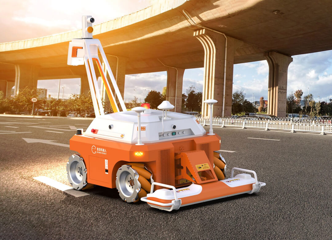
Robotic System for Road Disease Detection–An Expert for Precise Road Diseases Inspection at Project Level
Robotic System for Road Disease Detection
The road disease detection robot is a robot system specially used in project-level road disease investigation. It can accurately detect road surface and roadbed diseases in key areas according to the results of road network-level survey. The system is flexible in motion, and can complete turning and other actions in a single lane. Combined with high-precision positioning and navigation system, it can complete full automatic detection in the whole section. The system is equipped with two-dimensional and three-dimensional vision fusion system, as well as three-dimensional ground penetrating radar of different frequency bands. It collects road appearance and internal structure information synchronously. All kinds of data are accurately registered based on geographical position information. Combined with computer-aided analysis technology such as machine learning, the road appearance and internal information are fused on the same screen. The system can expand flatness, bearing capacity and other detection functions according to needs. The detection results can be customized to access the existing road information management system (road network information system), and combined with GIS and BIM models, the two-dimensional and three-dimensional visualized management can be performed on the disease.
System features
FUNCTIONAL FEATURES
Comprehensive
Full coverage of lane, road surface and roadbed structure disease
Accurate
centimeter-level positioning, high data density, good data quality consistency, high diagnostic accuracy for multi-type data fusion
Efficient
Data acquisition is automatic, data processing is intelligent
Safe
Intelligent obstacle avoidance, hard and soft dual emergency stop
Easy to use
Information fusion analysis of road and roadbed,visualized result output
Function parameter
Detection content:
Road disease: Cracks, pot hole, etc.
Type, position (accuracy 10cm), size (length error <5%, area error <10%)
Roadbed diseases: void, hollow, settlement, loose, watery.
Type, position (accuracy 5cm), depth, affected area, contour
Layer thickness: full coverage of the lane, accuracy 1cm
Concealed engineering: position and depth distribution of steel bars and dowel bars
Internal pipe network :(non) metal pipe and cable three-dimensional digital modeling
Single width: 0.9m-1.6m (customized)
Detection depth: 1m-3m (customized)
Operating speed: 0-10km/h
Positioning and navigation accuracy: 5cm
Endurance: 8h
System applications
Project acceptance:
Evaluation of layer thickness of road structure
Digital modeling of underground pipelines
Maintenance:
Fine survey of key road sections (based on road network census results)
Special investigation of maintenance
Preventive maintenance:
Preventive maintenance periodic monitoring
Road safety hazard investigation
Digital management of key road life cycle


